
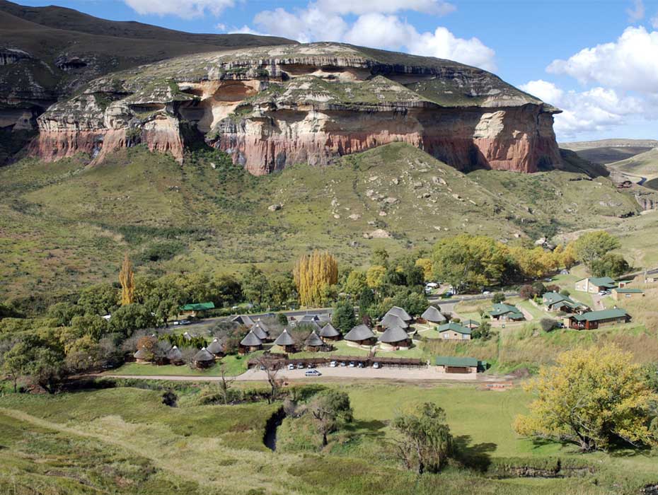
Golden Gate Highlands National Park
A Historical Overview
Early Inhabitants
The earliest people to inhabit the Golden Gate region were the Khoisan peoples, whose presence is evidenced by ancient stone implements and cave paintings scattered throughout the area. These hunter-gatherers made use of the numerous rock overhangs that provided natural protection from the elements.
The indigenous population dispersed during the early 1800s as Basotho communities and European settlers – including hunters, livestock farmers, and migrating Voortrekkers – began establishing themselves in the region.
European Settlement and the Great Trek
European colonization of the Golden Gate area commenced in the 1830s. The region became a passage route for many Voortrekker wagon trains traversing the untamed landscape. A notable event occurred on September 23, 1837, when Piet Retief’s party established camp in Liebenberg’s Kloof for nearly a week. During their stay, a hunting expedition led by Commandant Coenraad Meyer successfully harvested enough game to fill nine wagons with meat and animal hides, demonstrating the area’s abundant wildlife at the time.
This period coincided with widespread upheaval across the region, as military campaigns launched by powerful Zulu leaders Shaka and Dingaan, along with Mzilikazi of the Matabele, devastated many African communities throughout the northeastern Free State territories.
Territorial Conflicts and Border Disputes
Following European settlement, many refugees from Natal relocated west of the Drakensberg Mountains, some settling near Golden Gate. The absence of clearly defined boundaries led to frequent conflicts between Free State settlers and Basotho communities.
In 1846, Cape Governor Sir Percy Wodehouse was commissioned to establish boundary markers along the Rooiberge range. The first beacon was positioned atop what is now known as Wodehouse Peak, with a second marker placed on Bakenkop, located behind the current Environmental Education Center.
The region experienced British administration when the territory between the Orange and Vaal rivers was annexed by Sir Harry Smith. Following the Battle of Boomplaats, British control continued for an additional six years.
The Basotho Wars and Land Acquisition
Livestock theft became a persistent problem during this era. Chief Moshoeshoe launched a successful campaign against Sekonkela, gaining control over the Golden Gate area. After the Orange Free State achieved independence in 1854, several conflicts with Basotho forces ensued.
The conclusion of the second Basotho conflict proved significant for Golden Gate, as the farmlands that would eventually become the national park were incorporated into the Orange Free State through joint military efforts with the Transvaal.
Military engagements at Nauwpoort Pass and Paul Kruger’s involvement in later campaigns contributed to the establishment of Clarens, named after the Swiss town where Kruger spent his final years in exile.
Following the 1869 Treaty of Thaba Bosiu, war veterans were offered opportunities to purchase land along the Caledon River to strengthen border security. Surveyor-General A.G.P. van den Bosch demarcated three properties: Noord-Brabant, Vuurland, and Witsieshoek Spring.
Farm Development and Naming
The farm Vuurland was initially sold to Jacobus Charl Bender in December 1869 for £460. When Bender failed to complete payment, the government reclaimed the property and used it to compensate farmers who had suffered livestock losses during the Basotho conflicts.
The van Reenen family acquired Vuurland in 1878. Upon their arrival one evening, they witnessed a spectacular sunset illuminating two towering sandstone formations. The golden light reflecting off the cliff faces inspired them to name their new home “Golden Gate.”
Van Reenen was so captivated by the area that he persistently negotiated to purchase a 58-morgen section of neighboring Noord-Brabant in 1880 for just £50. In 1890, Abraham Albertus Cilliers divided his property between his sons, with one portion designated as Gladstone (now the site of administrative facilities and staff housing). In 1928, the younger Cilliers further subdivided Gladstone, naming the new section Wilgenhof, where the Environmental Education Centre currently operates.
The Anglo-Boer Wars
Golden Gate suffered extensive destruction during the Second Anglo-Boer War. Approximately 50,000 British forces occupied Bethlehem, forcing Boer commandos to retreat into the Rooiberge. When British troops secured the southern mountain passes, the main Boer force withdrew toward Golden Gate before General Prinsloo’s eventual surrender.
During their retreat, Boer forces abandoned heavy ammunition wagons and set them ablaze to prevent British capture. The intense fires left lasting scars on the landscape – some areas remain barren even today, with particularly visible examples near Mount Pierre where vegetation still cannot establish itself.
War casualties included A.A. Cilliers, who was imprisoned in Ceylon, and Jan van Reenen, held captive in Ladysmith. Military forces confiscated livestock, destroyed crops, and ransacked homes. Women and children were relocated to concentration camps in Harrismith, though Mrs. Cilliers chose to shelter her family in the area’s rocky caves and overhangs rather than face camp conditions – continuing a tradition of using these natural shelters that stretched back to the earliest inhabitants.
Establishment as a National Park
The South African government purchased the Golden Gate property in 1962 and transferred it to the National Parks Board. The following year, 4,792 hectares received official national park designation. The park expanded to 6,241 hectares in 1981, reaching its current size of 11,630 hectares in 1983. Today, Golden Gate Highlands National Park shares borders with QwaQwa National Park and the Kingdom of Lesotho.